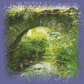
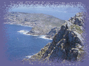
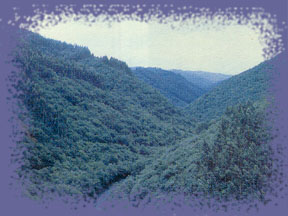
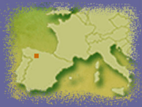
All Galicia is a natural space. Nowadays tendency is to protect these spaces as much as possible on behalf of the European Community in collaboration with statal and autonomic legislations.
All Galicia is a natural space. Nowadays tendency is to protect these spaces as much as possible on behalf of the European Community in collaboration with statal and autonomic legislations.
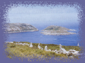
Galicia selected its comunitary important places (LIC) as a representation of the most appropiate places for its conservation. Together with areas of special protection for birds, (ZEPA) it constitues the long list of Natura net chosen in Galicia and from Galicia to the World.
It occupies a intermediate area between atlantic and mediterrranean vegetation , that´s why species appear in many cases mixed up.
We can distinguish many ecosystems:
Deciduous leaf forests, pine forests, mediterranean forest, eucaliptus
forest, riverbank forest, lakes, mountains, bushes, cultivations, rivers,
stuaries or marshes, rias, islands and islets and the open sea.
THE PRESTIGE CATASTROPHE
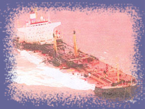
On 13 November 2002 a leak opened in the Belgian oil tanker Prestige which was opposite Galician seashore taking inside 77000 tons of fuel oil.
From that moment, the tanker began to lose big amounts of oil that not only put into a dangerous situation the natural heritage but it also affected many economic areas of this communitiy. Procedures taken by the Automic and Central Goverment were fiercely criticized.
Consequences of the ecological disaster in the soil:
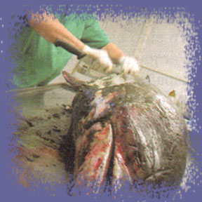
The animals that were in touch with oil died hopelessly. The rest has
little hope. Oil has killed by physic action most of the flora and fauna
species that live on the seashore, that space between sea and land that
we all could see in black and that exists from the upper end of high
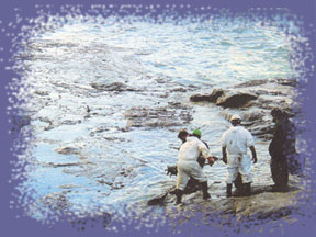
spring tides to the lower part of low tides. Concerning the volunteers
who came from all Spain and were cleaning the beaches, they have a high
risk of contamination with contact through skin and through inhalation
of fuel volatile components.
Consequences of the ecological disaster in the sea:
The leak affected largely to many fish species such as the conger eel,
the ray and the sole whose population rate will be affected in the short
run, what will have consequences in the food pyramid as well.
Consequences of the ecological disaster in the air:
The number of sea birds affected up to now ranges between 65000 and
13000, because only between a 10% and 20% is estimated to have been
collected due to the fact that most of them sank in the sea or were
devorated by other birds. According to recent data, 13221 were collected,
among those 3873 were alive and 9348 were dead. They belong to 62 different
species and were located on the France, Portugal and Spain seashores.
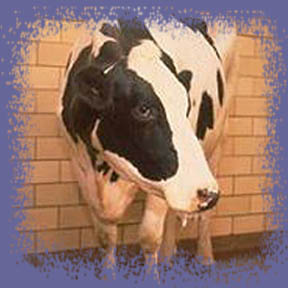
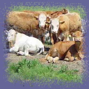
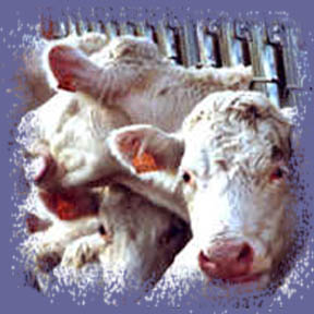
THE MAD COWS DISEASE
The bovine illness called “the mad cows disease” reached our country in the year 2000 and our comunity was the most affected one. The first case was detected in an animal in Carballedo (Lugo).
The symptoms of encephalitis in human beings better known as “mad cows disease” are : depression, anxiety, memory loss, coordination, vision, weight and rigidity as well. The victim dies in 13 months.
As a preventive measure all the rest of animals in affected explotations were sacrificed, several of them in LUGO province. Galician administration intensified the fodder controls to avoid animal concentrates which were already banned in Galicia and were considered to be related to the disease.
As a consequence of all this, the meat market prices dropped in spite of expets insistence in that danger for the consumption was almost none. Nevertheless, they didn´t suggest the consumption of viscera and brain together with the meat near the bones.
On the other hand, the European Comission had already warned that Spain was a country at risk although a high-ranking official of the EU tried to play the mistakes of the Spanish administration down.
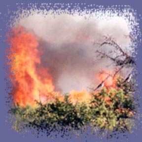
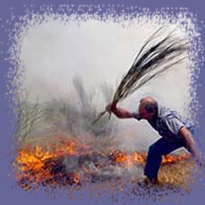
They are the main ecological problem in Galicia. In the last twenty years more than a third of the Galician surface has been burnt. 37% of the fires are started on purpose to clean the cultivations for pastures, to receive money from insurance companies, to take profit from burnt wood, to have soil requalified, out of personal revenges or pyromania.
Besides the social and economical effects, the ecological consequences are serious as well: in the soil nutrients diminish, erosion speeds up and changes in the structure and texture of it are produced. In the microclimate turbulences and winds increase and so does the termic oscilation. In hydric supplies an increase of wild water ( from the rain) and subterranean water diminish, rising the risk of floods. It also produces an increase in the number of suspension particles and the grade of eutrofization and the risk of appearance of red tides is higher.
In vegetation, an ecological regression starts because the fire stimulates the germination of some seeds and many annual herbaceous grows.
As far as fauna is concerned, many animals uncapable to escape die and others migrate.
Other effects are the increase of atmospheric contamination, the greenhouse effect and the accelaration of silting in dammings and the rias.
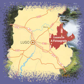
Situation: to the East of the province of
Lugo, bordering with León. The most important centers of population
are: Becerreá, Cervantes, Navia de Suarna, As Nogais and Pedrafita
do Cebreiro. In total, it comprehends a population of approximately
102.685 inhabitants.
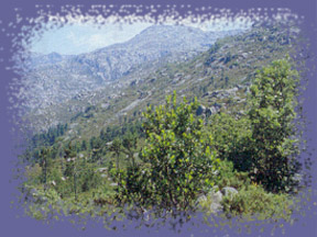
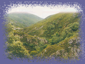
Flora and fauna: the mountain range is formed
by little valleys which are situated 250 ms above sea level, surrounded
by peaks around 2000 metres high. The tops have that rounded aspect
of old mountains. The main river in the area , which marks the regional
boundary to the West, is the source of Navia river, that flows into
the Cantabrian Sea ( the Bay of Byscay) in Asturias.
The highlands landscape creates a great biodiversity and its extense forests show a marked contrast throughout seasons. The variety is important not only because of its numerous species but also for its organisation in communities. The variety of cereal grown in the high mountains, meadows, holly forests, pastures, brushwood : heather, winged broom and broom. In the hillsides, species such as the oak, the hazel nut tree, the maple, the yew …. and in high areas, small birch trees woods.
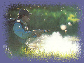
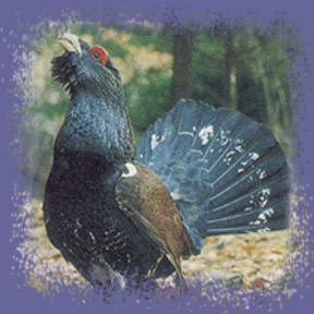
The fauna is very rich and diverse, due partly to its location in the most rugged of the four Galician provincies. The emblem of the Ancares fauna is the capercaillie. It can only be found in seven provincies in Spain. Another species in danger of extinction is the wolf. We can oustand as well the wild boar, the roebuck, the deer, the rabbit, the hare, the owl, the fox, the wildcat, the squirrel, the otter, the genet and we need to mention specially the trouts of the clear, crystalline and abundant rivers of the Ancares region.
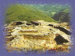
Etnography: Becerreá and A Pobra de Navia share the capitality of Ancares. Around 25 forts (casters) are spread all over the area , four fields of megalithic monuments , 20 caves related to minery in the Roman period and numerous “alzadas”, old temporary settlements used in summer.
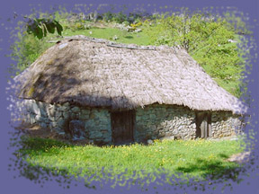
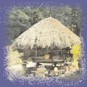
We´ll get to know another way of life represented in “pallozas” PreRoman constructions with the structure of forts which accommodated under the same thatched roof to people and cattle. Some “palloza” now turned into a museum shows the humble and beautiful cradles where its inhabitants were born not so long ago.
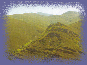
All the
territory in this region is situated in the Western Mountains in Lugo
province, and that´s the reason why its oreography, with vertiginous
profiles, is formed by narrow valleys encased between hillsides which
in some cases border on verticality and crowned by a series of outstanding
summits, whose maximum height is 1643 m.
The convergence of the Mediterranean and Eurosiberian climate turn the
oceanic climate in the region, into mountaneous climate in high ranges,
where you can appreciate, strong changes of temperature between winter
and summer, with a clear tendency to summer droughts.
From a hydrographic point of view, Lor river, tributary of Sil river
is the main river where other secondary rivers flow into.
The alternance of soils and the wet climate of the mountains allows
a rich variety of trees: beech, hazel, yew and birch trees, chestnut
trees, oaks, holly tree, and holm oaks…
This arboreal richness shelters a wide faunal variety : wolves, foxes,
badgers, manterns, genets, stoats, diverse migratory birds and others
that occupy less wooded environments, as the partridge or the eagle
owl, among others. Considering fish farming, trouts and eels are of
interest and from a hunting point of view, the rabbit, the hare, the
roe deer and above all the wild boar.
Demography
It reaches a demographic density of 9,9 inhabitants/km2. This low rate caused by the isolation of the area brings a lot of cultural, social and economic consequences.
Etnography
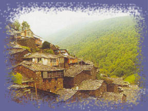
The etnographic
richness of the lands in Caurel is enormous : its small villages in
the depths of the region are a good indication of his architectural
adaptation to a hostile enviroment and the same thing happens to another
popular structures such as mills.
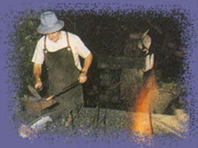
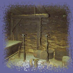
In this aspect, we need to pay our attention to blacksmiths and finally
to forges where all kind of utensils and tools were made.
Artistic heritage
All the
rural architecture in Caurel makes itself the best of historic-artistic
examples as we can see in the numerous little villages with its rounded-corner
houses, slate roofs and wooden balconies, but at the same time another
popular constructions are worth mentioning like blacksmith´s or
mills spread all over the municipality.We
also need to mention the remains of old towers, Galician palaces and
castles that are now preserved as live testimonies of the medieval past.
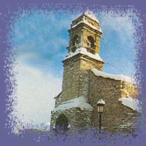
Finally, the religious architecture consists of a series of parishal
temples and chapels of the XVII and XVIII centuries, prefectly integrated
in their enviroment.
Tourism and leisure time
To discover
the natural beauty of the shire, we can follow several hikes on foot
or by bike which allow us to see among other things: little villages
with house with wide balconies of carved wood, autochthonous forests
with fountains all over the place and springs, mines of roman times,
caves with fabulous stalactites and stalagmites inside, cabins, casters,
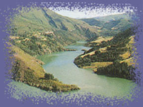
lake of glaciar origin, springs, centenary oaks .....
As far as handicrafts are concerned, we need to point our that in these
lands rudimentary looms already survive where canvas is still veaved.
Under the influence of a cold climate, gastronomy in this area is an
identity landmark. Traditional food always simple and with natural products
where pork and its derivatives are the protagonists. The stew, trouts,
and hunting and produts from the forests like chestnuts, blueberries
and mushrooms are the basics in the diet.
Situated on the Western-central border of Lugo´s province, Fonsagrada
relieves are very rugged over a extense and eroded platform which is dotted
with river valleys. In Fonsagrada´s landscape, the erosion has produced
an orography of rounded heights which alternate with valleys where Navia
and Suarna rivers flow into many of little streams.
Climatologically, being far from the coast and the big height average
of the lands – over 700 ms - originates a very tough mountanious
climate of moderate summers and cold winters, with frequent frosts and
abundant rains, with occasional snowfalls.
The dominant vegetation is constitued by chestnut trees, oaks and beeches
and in the heights, bushes grow on a wide surface on the hill protecting
the soil from erosion.
From another point of view, fauna in all the region has a special importance
for its ecological interest: picturesque landscapes, rich in vegetation
and plenty of the most diverse way of life.
Demography
A hostile physical enviroment, a bad net of communications and the limited economical resources provoked, above all in the forties, an emigration towards Europe and some Spanish cities. This brought as a consequence that lands were abandoned, that population was increasilgly getting old and the fall of demographic rate. Today, the demographic rate is slightly inferior to the one in 150. around 15 inhabitants/km2.
Etnography
During the long and cold winter nights and around the lareira (old traditional cook) a proper atmophere was created to pass on the rich patrimony that popular literature of the region possess. Fire, stones and water are the three of the symbolic elements that have a relevant role in most of these legends. In fact, the legend of “Fonte Sacra” gives its name to the capital of the municipality and it´s due to the fact that from old times an old fountain existed near the church of Santa María that from the XVIII century, was a center of pilgrimage and devotion. A fountain which was considered to be sacred by all for being the place where an apparition of the Virgin apparently took place.
Artistic heritage
Related to religious architecture, lots of churches can be named for keeping
inside Romanesque capitals and Reinaissance, Baroque and Neoclassic style
altarpieces.
On the other hand, rural architecture has its main manifestations in “pallozas”
( old traditional constructions) “ouriceiras” built to keep
the outer shell of chestnuts or “horreos” to dry and keep
the corn or to keep the derivatives of pork.
At the same time, numerous rural spots exist that have a huge architectonical
and etnographical interest where many typical constructions appear in
an architecture made with slate in the western hills.
Civil architecture has a special relevance as well and here some remains
of old fortresses outstand together with palaces and an old hospital founded
in the XIV century for the pilgrims that from Asturias made his way to
Santiago de Compostela through the Primitive Way route.
Tourism and leisure time
From any of its heights you have the possibility to enjoy the breathtaking
panoramic views. We have to add to this the varied architectural and monumental
richness existing. In this aspect, the seventy catalogued casters (old
preRoman settlements) are interesting together with a neolithic dolmen.
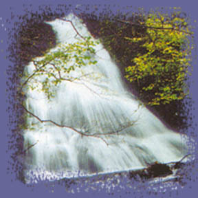
Many routes can be made by car, on foot or on horse and they will allow
you to arrive at many old settlements, viwepoints, reservoirs, waterfalls,
.....
Handicraft has a significant role in this area. Old traditional dooms
have been working almost till today and nowadays the making of knives
and penknives in little forges keep still alive the cultural heritage
together with the making of pots, adapting to nowadays trends.
Gastronomy is a tribute to the simplicity and naturality of its lands.
In many areas of the region, “butelo” made from pork- and
elaborated following the old tradition is a typical product. Many other
typical dishes exist elaborated with mayor hunting products adn river
species, always accompanied by chestnuts and mushrooms collected in the
mountains nearby, where they also obtain a vey well-known honey.
Finally, hunting and fishing lovers will find in this municipality the
best conditions for their practise.